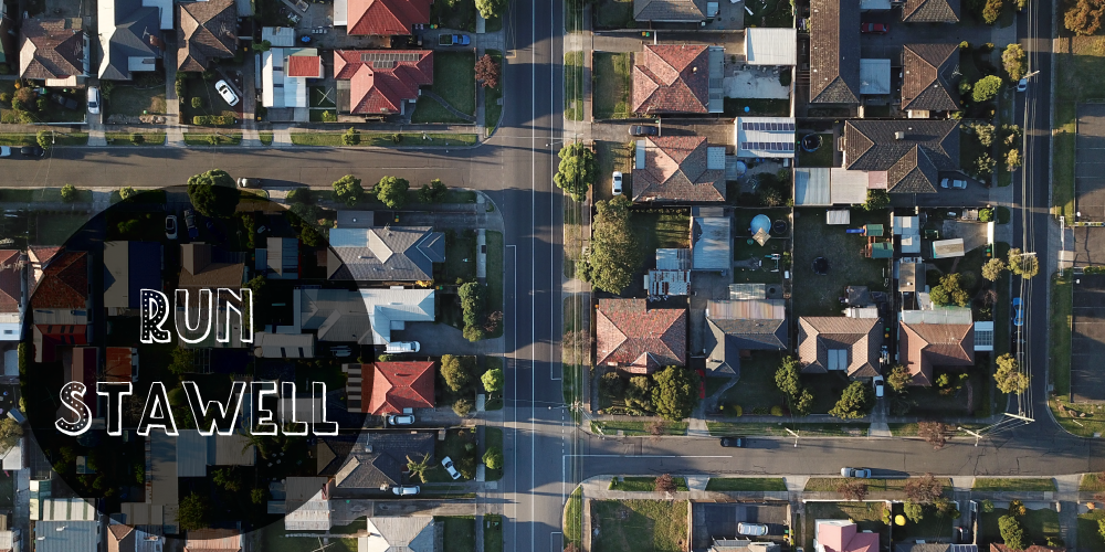
Back in October/November 2019, I decided to run every street in my home town, Stawell.
I was inspired after watching one of my Strava friends run every street in her suburb in Melbourne.
At the time I was knee-deep in training for an Ultra (Surf Coast). So the thought was put to the back of my mind.
After a reasonable amount of time off to recover from running my first 50k, the thought popped back into my mind. Since I had no other events on the horizon, I thought “Why not”. I needed a change. I needed an adventure.
On February 11, 2020, I crossed off my last street.
Just like that, my little challenge was complete.

It took me 54 sessions to run every street, and I learned a lot. About myself and my little hometown.
Tips for a Successful Run Every Street Challenge
.1. Set yourself some ground rules
This will be different for everyone.
Mine were as follows:
- I must take a photo on every run
- Note: not every street, just something on the run
- Share my runs on social Media
- I used Instagram & Strava (I used: RES#(insert number))
- Unless it was safe to do so, I would not run the highway
- I chose not to run the highway in the 100km speed zone. Even running against traffic, it was too high risk, and I value my life too much.
- Allow yourself grace
- There will be streets that you won’t be able to run, this accounts for that.
.2. Make a list of all the streets of your city/town/suburb
Google Maps, and MapShare (used to gazette streets by the council), are the tools I used to get my streets.
I used a spreadsheet to document all my streets. Each letter of the alphabet had its sheet. This made it easier to cross off.
As each street was completed, I would cross it off and date it.
I used different colours to represent different stages of completion.
Green – Complete
Orange – Incomplete
Blue – Street used as a thoroughfare
Pink – New (not on the original list)
Red – Unavailable/Does not exist
.3. Not every street is marked by a street sign
This may be a country thing, but the amount of streets that had no type of signage was astonishing (at least 25%).
I tend to listen to podcasts/audiobooks or music while running on my own. Therefore I have my phone with me. Carrying my phone was extremely handy as I was able to check to see if a track was just a track or was a road.
This is how I discovered a lot of unnamed roads that look like tracks but actually real streets.
.4. Not every street has public access
Some streets have a private lease agreement. This means as a member of the public you won’t have access to it.
There was one street that I was aware that I knew I would not be able to run. This was (part of, as it was split into 3 sections) of Hines Street. This particular street is leased by the abattoir and is fenced off.
On one of my last runs of this challenge, I discovered that Anderson St was blocked off by a new fence/gate. Double-checking Google Maps, I was in the right location. Did I jump the fence? Yes. I wasn’t turning back. Did I get caught? No. And even if I did, I was a runner, and really, I think if I were caught by a farmer, I can only assume he could see I would be completely harmless.
.5. Plan your route

Before each run, I would decide what street to cover and then plan a route around that street.
I would simply use Google Maps to map out my run.
To do this with Google Maps (has to be a PC), right-click, and select Measure Distance. This will allow you to map your course.
.6. Arrange drop off’s
The only way I was going to get this challenge complete, was with the help of my husband. He would drop me off, and then I would run back in.
Otherwise, you may find yourself doing very long runs. If that’s your thing, then yay, but if not, just get dropped off.
.7. Have fun
I came across some really interesting things.
- An old horse carriage
- Cool & interesting letterboxes
- Beautiful trees
- Animals
- An old telephone box
It’s easy to run the same route on runs. Hello! Guilty as charged there.
That’s why I enjoyed this challenge. Now I have plenty of new tracks to enjoy of all distances.
Now I have a whole list of new routes to add to my old old familiars.
Run Stawell Fun Facts
- Shortest Street – Hobbs St @ 45m’s
- Longest Street – Stawell-Donald Rd @ 9.5km
- Prettiest Street – Grandard Park Rd
- Street with the highest Elevation – Reef’s Road